
Location
Agent Comments
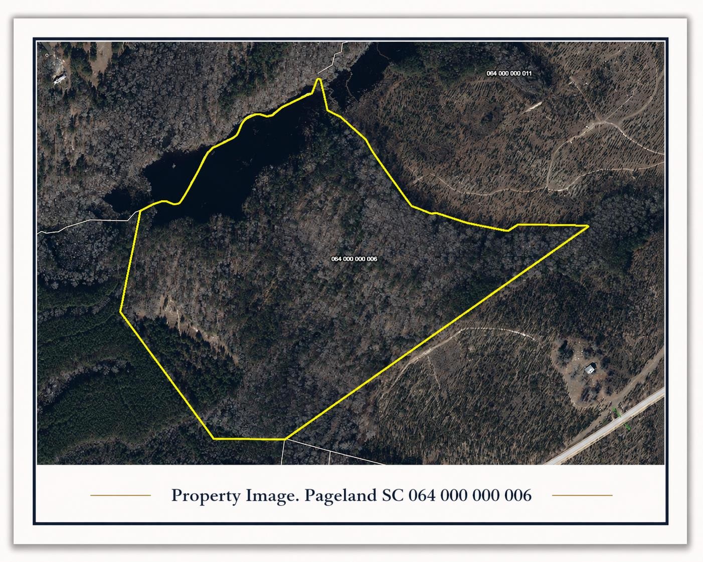
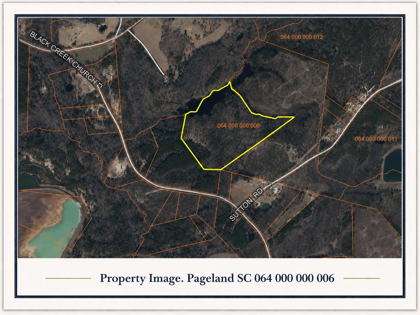
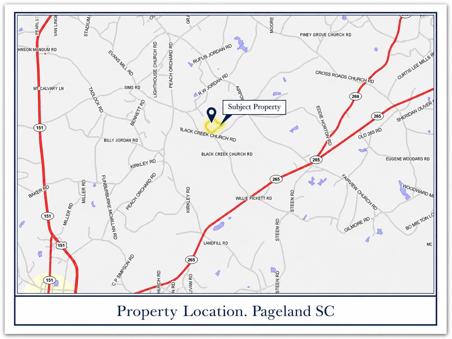
Explore the possibilities with this approximately 44.9-acre agricultural-use tract in Chesterfield County. The parcel offers a mostly wooded rural setting with natural privacy, open recreational potential, and a visible pond/water feature shown on the parcel aerial. With no buildings currently assessed on the property, this tract provides a blank canvas for buyers seeking land for recreation, timber, hunting, outdoor use, or a private rural retreat. The property is identified as Map/Parcel Number 064 000 000 006 and carries an agricultural-use property class description. The county parcel report lists 44.9 acres, a legal description of 44.9 acres, and no assessed building value, making this a land-focused opportunity. The property is landlocked and priced accordingly. Conveniently located in the High Point fire district area, the parcel sits in a quiet rural setting near the Black Creek Church Road and Sutton Road area, according to the map image shown in the parcel report. Buyers should verify access, road frontage, easements, survey/boundary lines, zoning, utilities, soil suitability, permitted uses, and any agricultural-use tax implications to their satisfaction.
Additional Features
- County: Chesterfield
- Tax Number: 2147483647
- Waterfront Features: Pond
- Water/Sewer: Electricity Available, Sewer Not Available